GIS & Photogrammetry Services

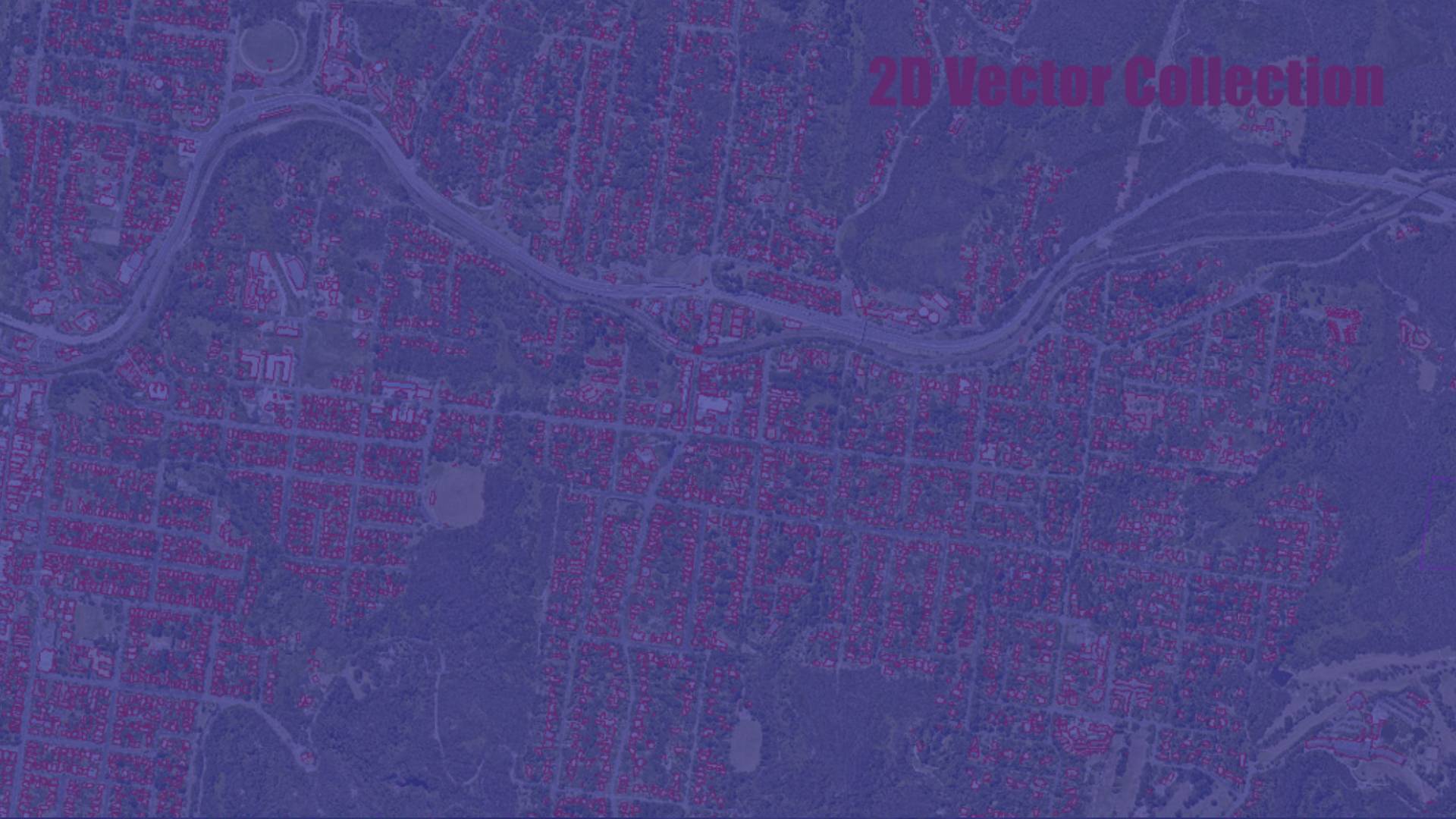
Our well-knit solutions for photogrammetry and remote sensing services gives you,data accuracy and performance throughout the project life cycle.

Portfolio Image

DEM & DTM Services

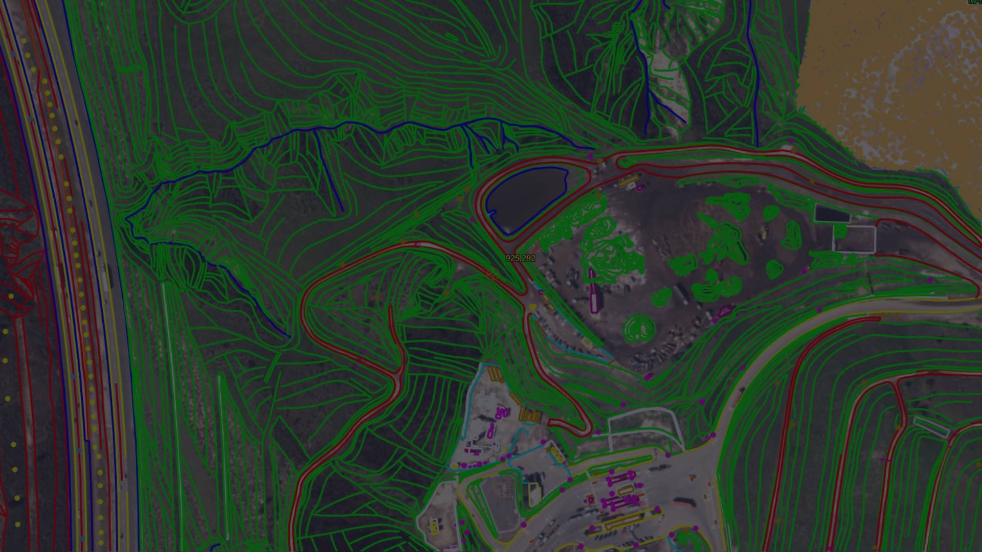
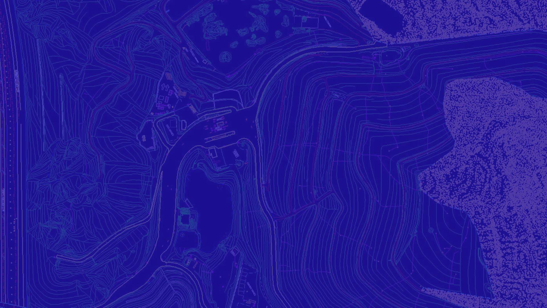
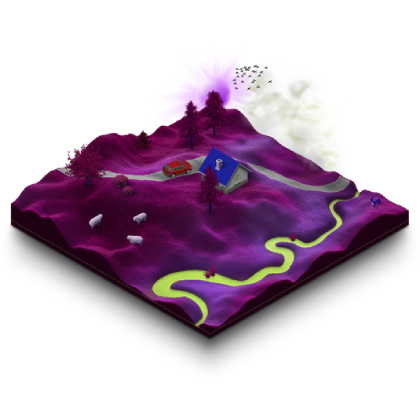
The Digital elevation model refers to the change in terrain relief or the sudden deviations in slope. Digital terrain models on the other hand represents

Portfolio Image

LIDAR Scanning & Classification

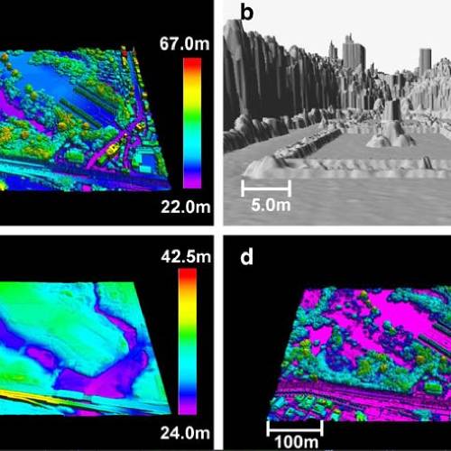
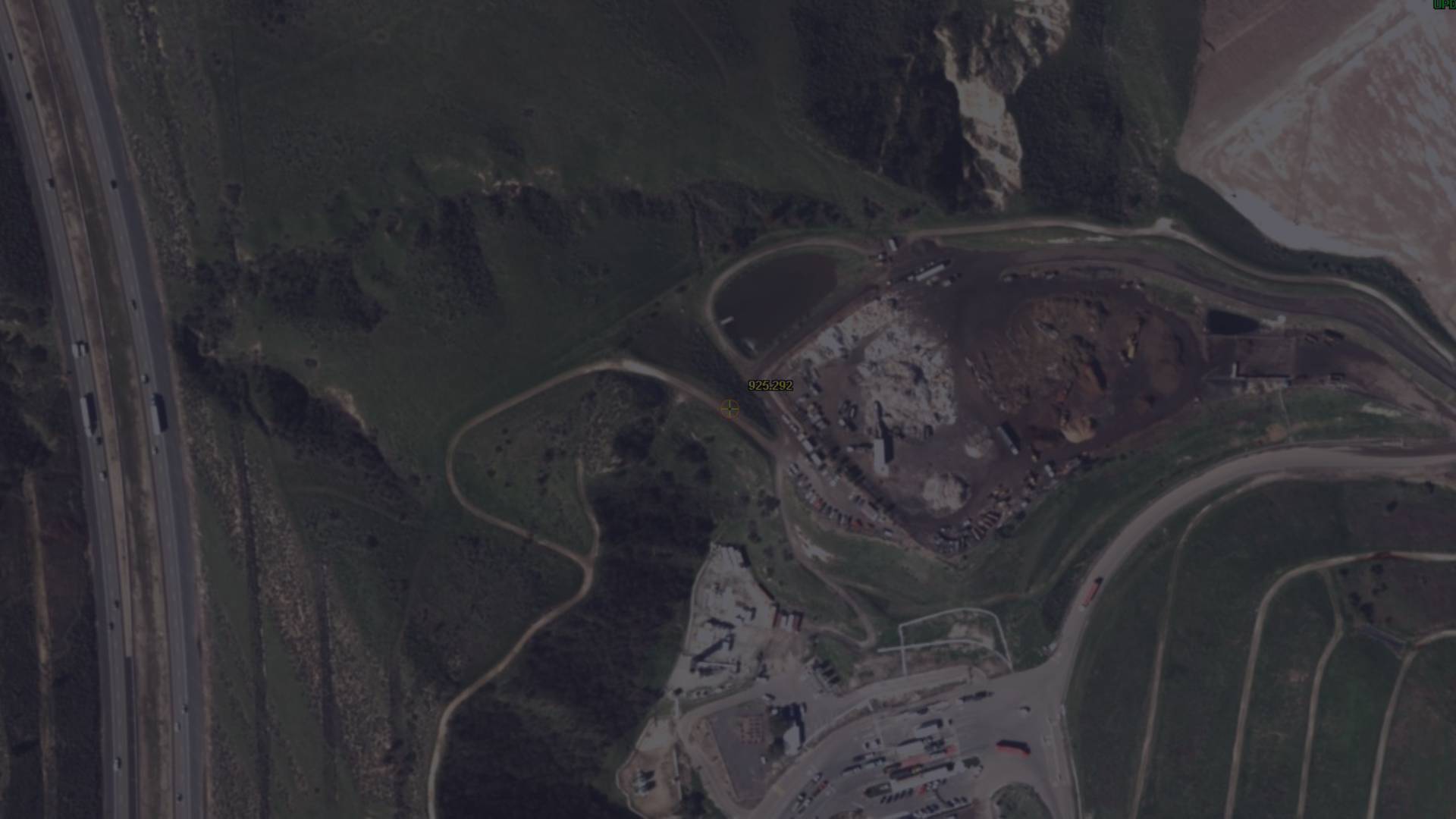
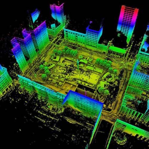
Light Detection and Ranging (LiDAR) systems generate accurate height data and intensity images with the aid of IMU and GPS data

Portfolio Image

Software Development Services

We have an in house development team who always mingle with our customer teams to develop the needs, so if you have any requirements

Portfolio Image

Why Us?

Trust, Committed, Support are words many companies use. For 19 long years, we have lived by these words to show our integrity towards clients and consultants. ISRO "India's Prestigious Organization" as recognized and partnered with us through out of our journey in accomplishing client's requirements and requests.

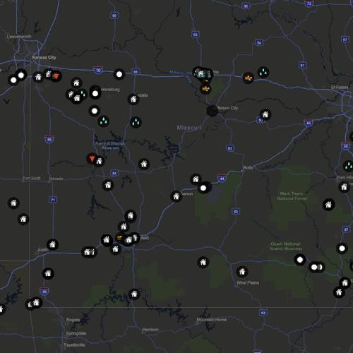
We have supported GIS Mapping Services, GPS tracking solutions, Fleet management, E2E Fleet Tracking of PAN India. There is pride in our commitment for finding the right solution to the client as we provide highly capable professional for a project, we undertake. Meeting Clients expectation is important, but more crucial point we follow is to provide CONFIDENCE in our 100% successful deliverables. Our professional family is serving clients all over the world and our professionals are trained/updated with latest technologies to help them find more advanced development and innovative solutions for any industry.

Trans Global Geomatics (TGG) motto "Motivation, Integrity, Commitment are now and forever, One and Inseparable". Our relationship with Clients and Consultants is also inseparable when it comes to Support and Service. We are an Industry that provides excellence to Industry Leaders. Trans Global Geomatics - Sincerely thanks you for support and commitment.

More...
This method can significantly reduce the number of ground control points (GCPs). However, the establishment of GPS reference stations for DGPS positioning is not only labor-intensive and costly, but also increases the implementation difficulty of aerial photography.
This technology includes both Satellite and aerial remote sensing. The basis source for this technology is electromagnetic radiation and this energy from the sun reaches the earth surface and again reflected or transmitted or absorbed by the objects which is collected by the satellite sensors or recorded in the photographic film.
The increase in spatial resolution of satellite sensors is increasing the demand to extract topographic features at various mapping scales through remote sensing and photogrammetric techniques.
DEM is the simplest form of digital representation of topography. DEMs are used to determine terrain attributes such as elevation at any point, slope and aspect. Today, GIS applications depend mainly on DEMs.

Services

LiDAR Data Processing

LiDAR is the most comprehensive and precise data capturing practice to create elevation models of surfaces compared to other methods.

Orthophoto Generation | Orthorectification

Satellite imagery and aerial photographs play an important role in general mapping, as well as GIS data acquisition and visualization.

Edge Matching

Edge-matching is one of the most useful techniques in the process of spatial data. A lot of data must be organised in a proper form to meet different needs.

Digital Elevation Modeling & Editing (DEM,DTM)

The digital elevation model (DEM) is a digital representation of ground surface topography or terrain.

3D Terrain Visualization

3D terrain visualization of geographic information systems (GIS) data has become an important issue in recent years.

Triangulated Irregular Network (TIN)

The TIN model represents a surface as a set of contiguous, non-overlapping triangles.

Our Valuable Clients

Top