Services
Services
Our well-knit solutions for photogrammetry and remote sensing services gives you,data accuracy and performance throughout the project life cycle.
The Digital elevation model refers to the change in terrain relief or the sudden deviations in slope. Digital terrain models on the other hand represents
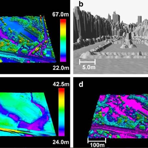
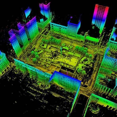
Light Detection and Ranging (LiDAR) systems generate accurate height data and intensity images with the aid of IMU and GPS data
We have an in house development team who always mingle with our customer teams to develop the needs ,so if you have any requirements